How to use REAL Maps?
Three simple steps to transform your project from concept to reality
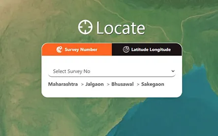
Step 1


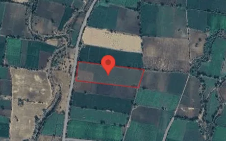
Step 2

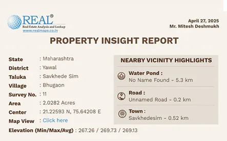
Step 3

One Platform. Multiple Industries. Infinite Possibilities.
REAL Maps is ADL's flagship Land Intelligence Platform that combines satellite land surveys, GIS
mapping, digital land records, cadastral maps and AI-powered geospatial analytics to deliver
accurate land insights. Built on authentic cadastral data and high-resolution satellite imagery,
REAL Maps empowers individuals, businesses, banks and government organizations to make faster,
smarter and more confident land and real estate decisions across India.
By integrating survey number records, property boundaries, cadastral maps, satellite imagery, GPS coordinates (Latitude & Longitude), 7/12 (Sat Bara) and advanced land analytics, REAL Maps simplifies property verification, land verification, survey number search, land parcel mapping and plot boundary checks through a single intelligent platform.
Three simple steps to transform your project from concept to reality
Survey-verified boundaries and digital maps that accelerate due diligence and dispute-free transactions.
Read More →Geo-tagged farm verification, crop intelligence and portfolio monitoring for smarter, secure agricultural lending.
Read More →Historical crop and land data for accurate underwriting, faster claim validation and informed insurance decisions.
Read More →Verified cadastral maps and survey-based land intelligence for infrastructure planning and land acquisition
Read More →